
Key Takeaways
- Typhoons and hurricanes are both intense tropical cyclones occurring in different oceanic regions but sharing similar meteorological characteristics.
- Typhoons typically develop in the Northwest Pacific Ocean, while hurricanes form in the Atlantic Ocean and Northeast Pacific.
- Differences in naming conventions, regional impacts, and seasonal patterns distinguish typhoons from hurricanes.
- Both storm types can cause devastating winds, heavy rainfall, and storm surges, severely affecting coastal populations and infrastructure.
- Understanding regional preparedness and response strategies is crucial due to the geographic differences between typhoon and hurricane-prone areas.
What is Typhoon?

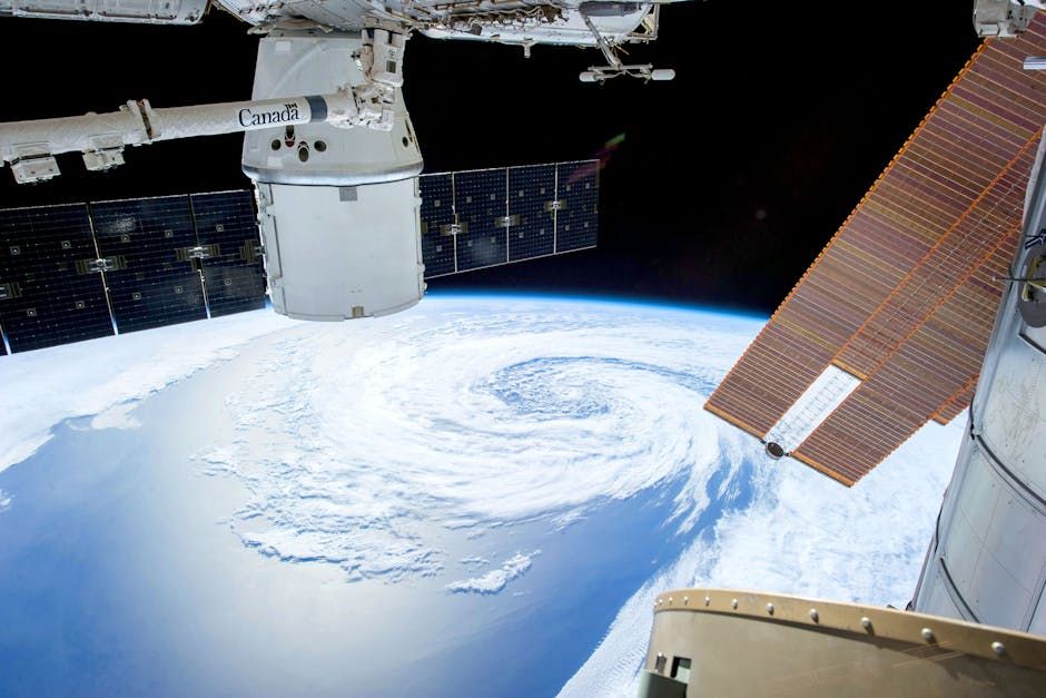
A typhoon is a mature tropical cyclone originating in the Northwest Pacific Ocean, typically east of the Philippines and south of Japan. It is a regional term used to describe intense storms with sustained winds exceeding 74 mph.
Formation and Development of Typhoons
Typhoons form over warm ocean waters where sea surface temperatures exceed 26.5°C, providing the energy needed for storm development. This process typically begins with a low-pressure system that intensifies through the release of latent heat from condensing moisture.
The monsoon trough, a climatic feature in the Northwest Pacific, often acts as a breeding ground for typhoons by creating conducive atmospheric conditions. Additionally, the Coriolis effect helps spin the system, enabling the cyclonic rotation necessary for typhoon formation.
Storms tend to strengthen as they travel westward or northwestward, often impacting countries such as the Philippines, Taiwan, Japan, and coastal China. The interaction with land or cooler waters can weaken these systems, but some typhoons maintain strength over extended distances.
Seasonality and Frequency
Typhoon season peaks between June and November, aligning with the warmest months in the Northwest Pacific. However, typhoons can occur year-round due to the vastness of the area and varying oceanic conditions.
The Northwest Pacific basin experiences more tropical cyclones annually than any other region, averaging around 25 to 30 storms, with about half reaching typhoon intensity. This high frequency contributes to recurrent challenges in disaster management across affected nations.
Early season typhoons often form near the equator and move northwest, whereas late-season storms tend to develop closer to the Asian continent. These patterns influence the timing and severity of impacts on coastal communities.
Impact on Affected Regions
Typhoons often bring destructive winds exceeding 150 mph, causing widespread damage to buildings, power infrastructure, and vegetation. Coastal flooding and storm surges pose significant risks, especially in low-lying areas like the Philippines’ archipelago.
Heavy rainfall associated with typhoons leads to river flooding and landslides, which frequently result in casualties and displacement. Countries in the typhoon belt have developed advanced early warning systems and evacuation protocols to mitigate these effects.
Economic disruptions from typhoons include damage to agriculture, fisheries, and transportation networks, often costing billions in recovery efforts. The social ramifications include long-term displacement and challenges in rebuilding vulnerable communities.
Classification and Naming Conventions
Typhoons are classified using categories based on sustained wind speeds, with the Japan Meteorological Agency and Joint Typhoon Warning Center providing official designations. These scales help communicate storm severity to the public and emergency services.
Names are assigned from predetermined lists contributed by countries in the region, reflecting cultural diversity and regional identities. Unlike the Atlantic hurricane naming system, typhoon names can include animals, flowers, and geographical features.
This naming process aids in international cooperation and reduces confusion when multiple storms occur simultaneously in the Pacific basin. Notably, names are retired when storms cause significant damage or loss of life, preserving sensitivity towards affected populations.
What is Hurricane?
A hurricane is a tropical cyclone that occurs in the Atlantic Ocean and the northeastern Pacific Ocean, characterized by powerful winds and heavy precipitation. The term specifically applies to storms with sustained winds of at least 74 mph.
Formation and Atmospheric Conditions
Hurricanes originate over warm ocean waters where the surface temperature surpasses 26.5°C, generating the necessary heat and moisture. A cluster of thunderstorms organizes around a developing low-pressure center, intensifying into a cyclone through energy release.
The subtropical ridge often influences the path of hurricanes, steering them westward toward the Caribbean, Gulf of Mexico, or eastern United States. Wind shear and cooler ocean temperatures are primary factors that can weaken or inhibit hurricane development.
Hurricanes typically undergo rapid intensification when moving over exceptionally warm waters, sometimes doubling their wind speeds within hours. This phenomenon complicates forecasting and emergency preparedness for coastal regions.
Seasonal Patterns and Activity Levels
The Atlantic hurricane season officially runs from June 1 to November 30, with peak activity between August and October. This period coincides with optimal oceanic and atmospheric conditions for cyclone formation and growth.
On average, the Atlantic experiences about 12 named storms annually, with six reaching hurricane strength and three becoming major hurricanes (Category 3 or higher). Variability in activity is influenced by phenomena such as El Niño and La Niña, which alter wind shear and sea surface temperatures.
Hurricane frequency and intensity have shown trends linked to climate variability, prompting increased research into forecasting models and mitigation strategies. Coastal urbanization further amplifies vulnerability to hurricane impacts.
Geographical Impact and Vulnerability
Hurricanes often ravage coastal areas of the southeastern United States, Mexico, the Caribbean islands, and parts of Central America. These storms cause extensive damage through wind destruction, flooding, and storm surges, affecting millions of residents.
Infrastructure such as homes, roads, and power grids frequently suffer severe impairment, requiring costly rebuilding efforts. In addition, hurricanes disrupt economic activities, including tourism and agriculture, with long-lasting repercussions.
Emergency management agencies in hurricane-prone regions have developed sophisticated forecasting technologies and evacuation plans to reduce human and economic losses. However, densely populated coastal zones remain at elevated risk.
Classification Systems and Naming Protocols
Hurricanes are classified using the Saffir-Simpson Hurricane Wind Scale, which categorizes storms from 1 to 5 based on sustained wind speed. This scale provides a clear indication of potential damage and helps guide response measures.
The World Meteorological Organization maintains rotating lists of names for Atlantic hurricanes, alternating between male and female names. Names are retired when storms are exceptionally deadly or costly, preserving respect for affected communities.
This standardized naming system facilitates communication among meteorologists, media, and emergency responders, improving public awareness during storm events. It also aids in historical record keeping and disaster research.
Comparison Table
The following table highlights key distinctions and similarities between typhoons and hurricanes in terms of their geographic, meteorological, and societal aspects.
| Parameter of Comparison | Typhoon | Hurricane |
|---|---|---|
| Oceanic Basin | Northwest Pacific Ocean | Atlantic Ocean and Northeast Pacific Ocean |
| Typical Path | Westward or northwestward towards East Asia | Westward or northwestward towards the Americas |
| Annual Frequency | Approximately 25-30 tropical cyclones | About 12 named storms |
| Peak Season | June to November, with year-round possibilities | June 1 to November 30, peaking August to October |
| Regional Naming Authority | Japan Meteorological Agency and regional bodies | World Meteorological Organization (Atlantic) |
| Impact Regions | Philippines, Japan, Taiwan, China, and surrounding areas | Caribbean, Gulf Coast, Southeastern United States, Mexico |
| Classification Scale
|